Drive, Car tab and features
This is a test version. Screens and features will change as testing continues, and this guide may lag behind the app. Pictures use made-up sample data.
The five tabs
- Drive: the live map and readings, and Start Trip.
- Trips: every trip you've recorded.
- Places: places you've saved, such as Home, Work or a speed bump.
- Car: statistics and tips from your own driving, and the fuel log.
- Settings: see the Settings guide.
The Drive map
The Drive tab shows a map that follows you. During a trip it draws the route so far. Your earlier trips and saved places show on the map too (switch them off in Settings → Maps).
- OBD status: shows the adapter: not paired, searching, connected, or "Simulated". Tap it for its menu, where you can pick the vehicle.
- Map buttons: your location, and Mark this spot, which saves a place where you are with one tap (handy for a pothole while driving).
- Add Refuel and Add Expense show only while the car is stopped, because their forms need typing.
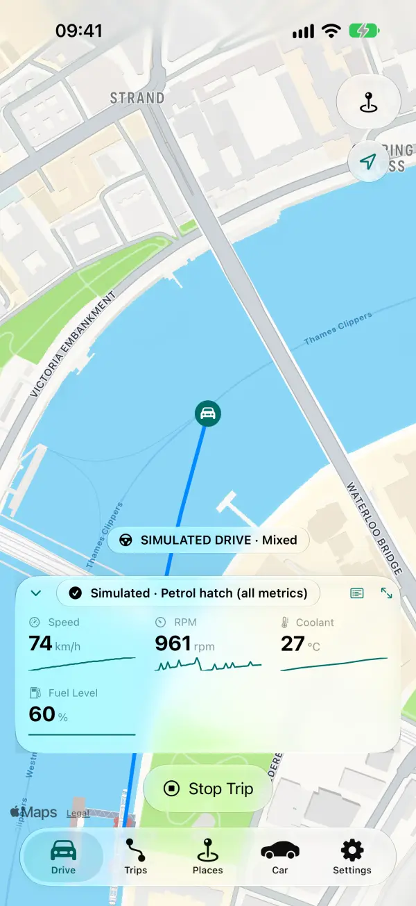
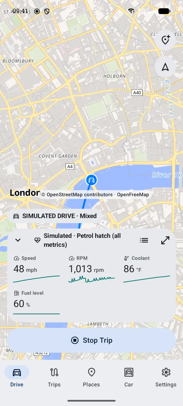
Tiles and the minimised bar
The tiles at the bottom show 2 to 6 live readings, such as speed, RPM and coolant temperature, each with a small graph of the last minute. You choose them for each vehicle.
- Touch and hold a tile to reorder or replace tiles.
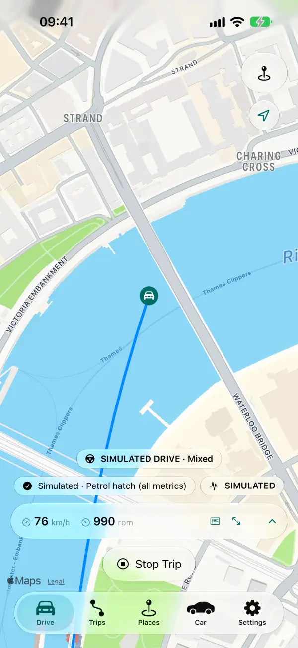
- Swipe the tiles down (or tap the minimise button) to shrink them to a slim minimised bar and see more map. Swipe up to bring them back. The app remembers your choice.
- The minimised bar shows 1 to 3 readings. Choose them in the tile editor's Minimised bar section; until you do, it shows your first two tiles.
- Without an adapter, the tiles show GPS values: speed, distance, duration and altitude.
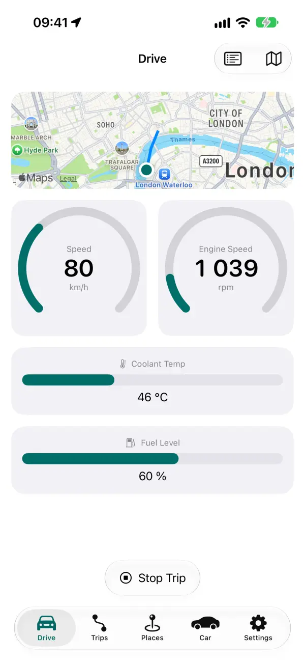
The dashboard
Swipe sideways on Drive, or tap the dashboard button, for large gauges: dials for speed and RPM, bars for temperatures and fuel. The map shrinks to a small inset. Use the Gauges menu in the dashboard's bar to choose what shows.
All Data
The All Data button on Drive lists every reading your car is giving right now, whether it's recorded or not, then live GPS (speed, altitude, heading, accuracy) and the adapter's voltage.
- Each row shows where the value comes from (OBD, GPS or Adapter).
- A reading that hasn't updated for 10 seconds is greyed out.
- While the car is stopped you can reorder the rows (iPhone: Edit; Android: Reorder). The order is saved for that vehicle.
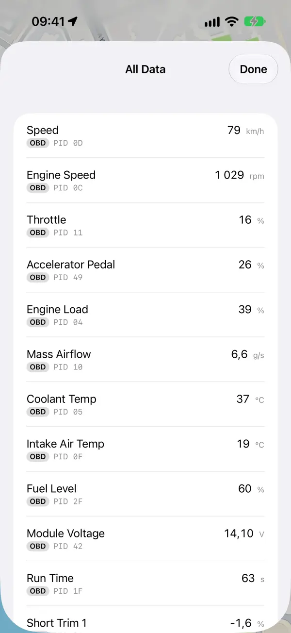
The inclinometer
The inclinometer is a dashboard gauge for off-road driving. It shows the car's pitch (nose up or down) and roll (one side down) in degrees, under an artificial horizon like an aircraft's. It uses the phone's own motion sensors, so it works without an adapter. Nothing is recorded.
- Without an adapter, tap the dashboard button on Drive and the inclinometer opens on its own.
- The phone must be held firmly in a mount.
Set Level
Park on level ground with the phone in its mount and tap Set Level (Android: Set level). This only works while the car is stopped. Do it again whenever you move the phone in its mount.
The Gauges menu
The Gauges menu in the dashboard's bar has the inclinometer's options:
- Inclinometer: show or hide it.
- Roll warning and Pitch warning New in the next test build: each axis has its own warning angle: Off, or 20° to 45° (30° to begin with). Past it, that figure turns red with a warning sign. The dial's red arcs follow the roll warning.
- Roll alarm and Pitch alarm New in the next test build: off to begin with. Turned on, the phone sounds and vibrates once when that axis reaches its warning angle. Roll is two short high beeps; pitch is one lower, falling tone, so you can tell them apart without looking. It won't sound again until the angle is back at least 2° inside the warning. The sound follows the phone's silent switch and volume, and plays over music or navigation.
- Horizon New in 0.3.4 / 0.2.4: Follow the car (to begin with) turns the horizon the way the car tilts. Aviation keeps it level with the world, like a real aircraft instrument, so it turns the other way. The figures are the same either way.
The settings are kept for each vehicle on this phone. The alarms only sound while the gauge is on screen and the app is open.
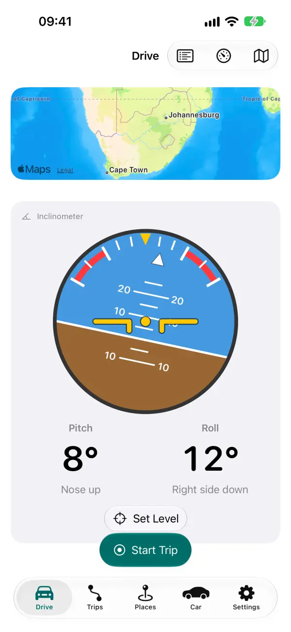
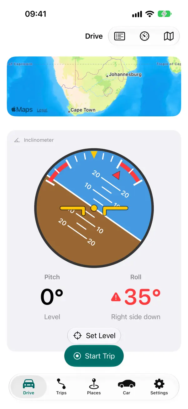
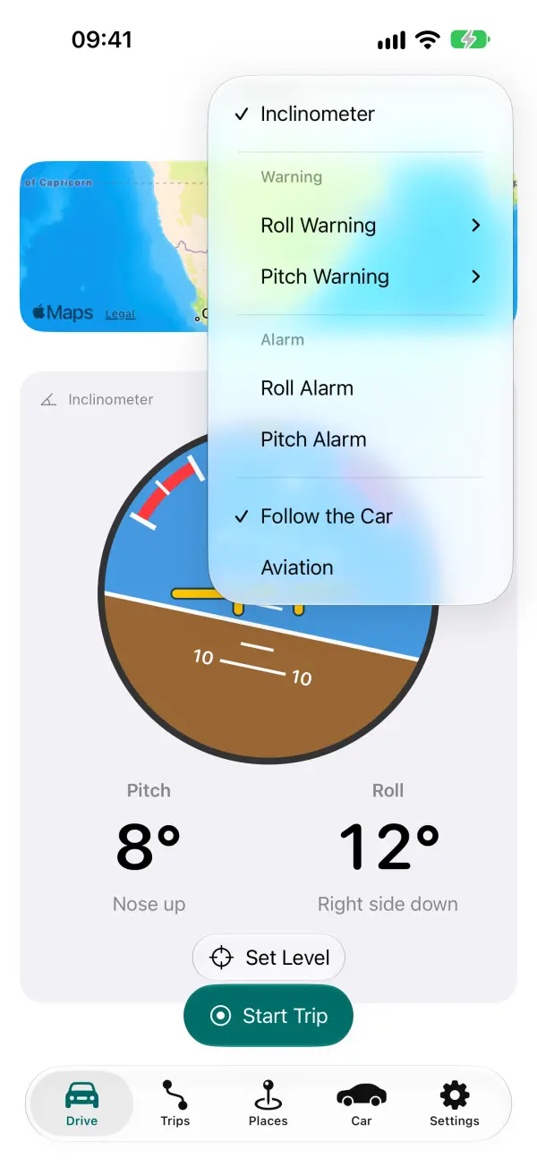
Trips
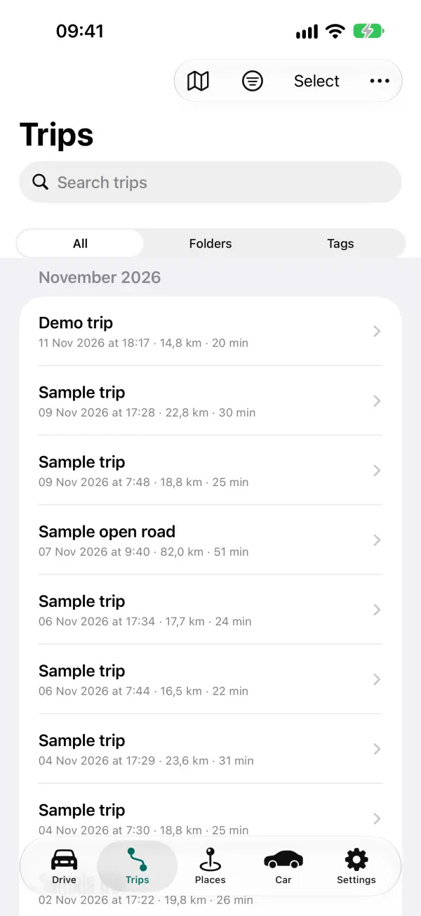
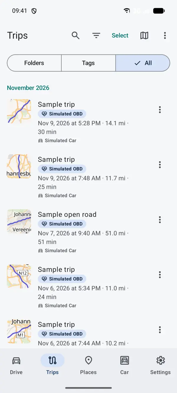
The Trips tab lists your trips by month, newest first, with distance, time and vehicle.
- Switch between Folders, Tags and All at the top, and filter by vehicle.
- Search by name, place, tag or notes.
- Tap Select to move, tag, merge, show or hide on the map, export or delete several trips at once.
- The Map button shows all your trips on one map.
- Deleted and short trips go to Recently Deleted (in Folders) for 30 days.
Trip detail and charts
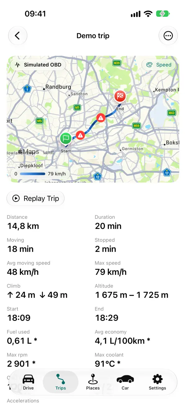
Tap a trip to open it. You'll see:
- A map of the route, coloured by speed (or another reading you choose), with pins for events such as harsh braking.
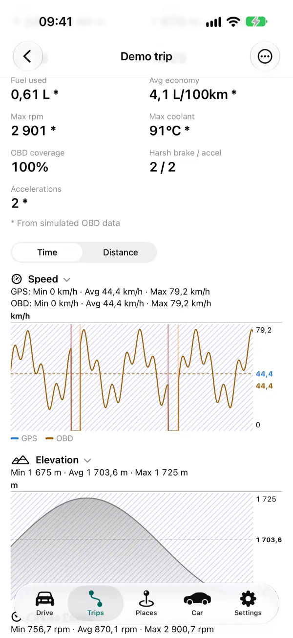
- Figures: distance, time, moving time, speeds, height gained, fuel used, economy, accelerations and more. A figure with no data isn't shown.
- Charts for speed (GPS and OBD together), elevation, temperatures, voltages and each recorded reading. Under each title is the minimum, average and maximum.
Using the charts:
- Touch or drag on a chart to see values at that moment: an orange line shows on every chart and a marker on the map. Tap the route to do the same from the map.
- Pinch to zoom in on part of the trip.
- Switch the bottom axis between time and distance.
- Tap a chart's title to collapse it. The app remembers this for that kind of chart.
The trip's menu also has Rename, Move, Tags, Export, Trim (cut off the start or end) and Delete, and Replay plays the trip back on the map.
The Car tab
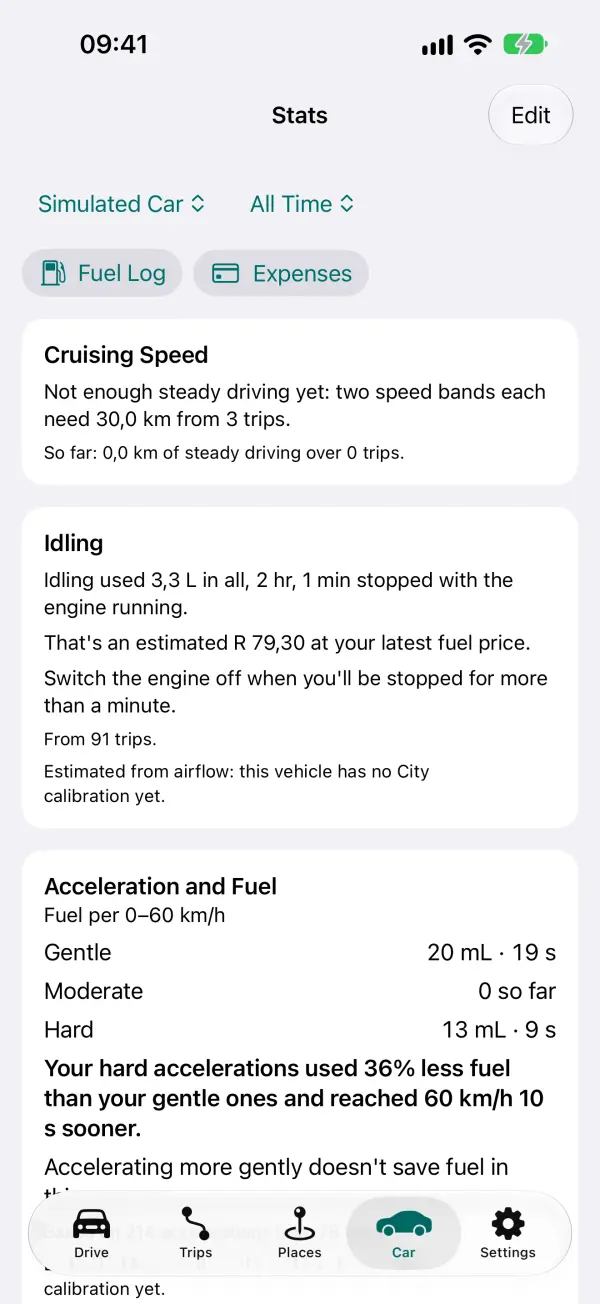
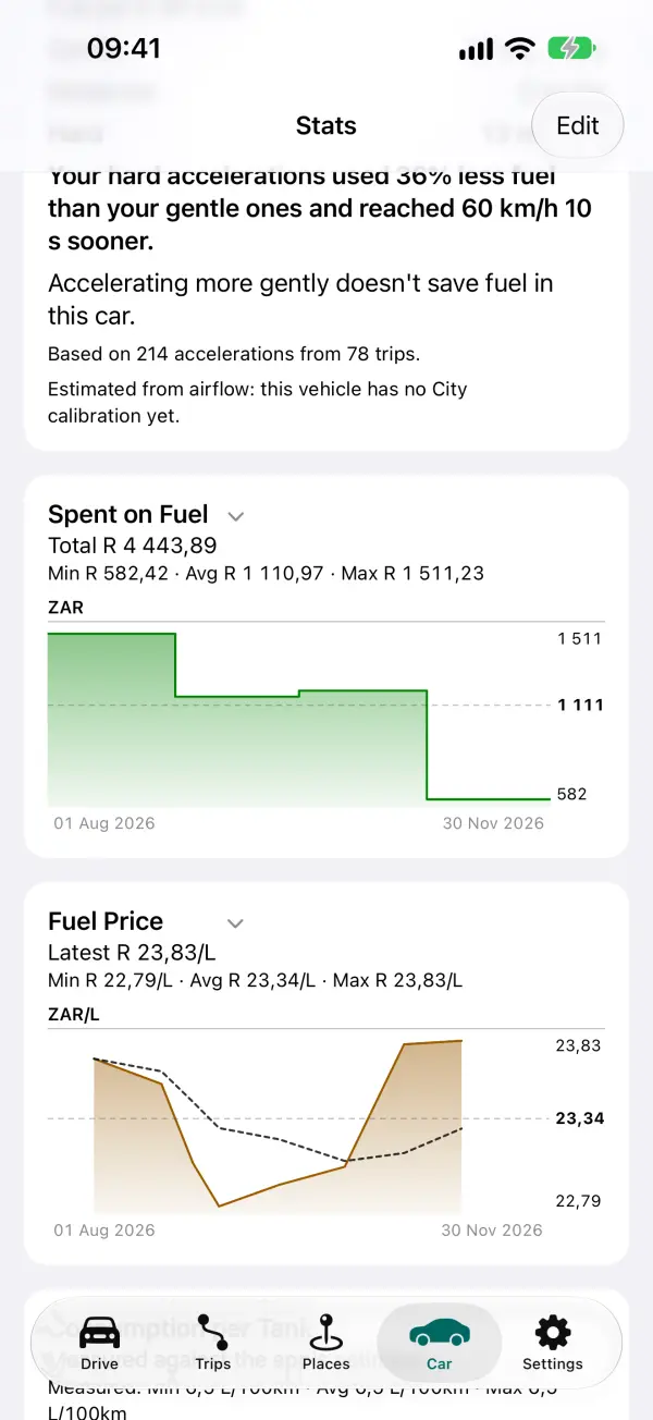
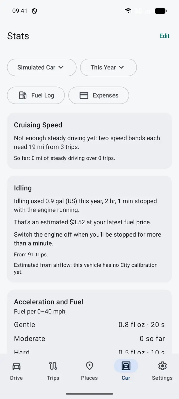
The Car tab shows statistics from your trips, refuels and expenses for the vehicle you pick at the top, over the period you pick (such as this month, this year or all time).
- Fuel Log and Expenses buttons open those lists for the vehicle.
- Cruising Speed: compares your fuel use at different steady speeds, and says how much a slower cruise would save.
- Idling: how much fuel you used stopped with the engine running.
- Acceleration and Fuel: compares your gentle, moderate and hard accelerations, and the fuel each used.
- Fuel, Brand and Grade, Spending and Driving: graphs of money spent, price, consumption, cost per km, distance and time driven.
The tips need enough history (for example 3 trips with steady driving at two speeds) and say what they're based on. Tap Edit to put the sections in the order you like. Touch a graph to see the month or refuel under your finger.
New in 0.3.4 / 0.2.4 The Car tab opens faster with many trips: each trip saves what the tips need when it finishes, and older trips are filled in once in the background.
Fuel log and refuels
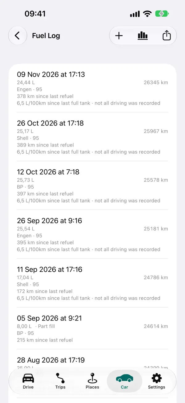
Log each refuel to get your real fuel consumption, cost per km and a better range estimate.
- Add one from Add Refuel on Drive (when stopped), or Car → Fuel Log → Add Refuel.
- Enter the odometer, the amount, and two of price per litre, total and amount (the third is worked out). The odometer is filled in from the car when it reports it, or estimated from your trips.
- Leave Full tank on when you fill to the top. Consumption is measured from one full tank to the next.
- Forgot to log one? Turn on Missed refuel before this one on the next.
- Brand and grade are optional; they feed the Brand and Grade graphs.
Places
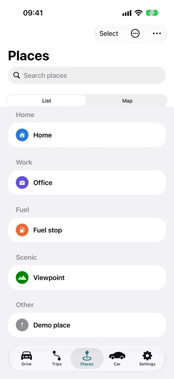
A place is a named spot with a category (Home, Work, Fuel, Hazard and others) and a size. Places name your trips ("Home → Work") and can warn you as you approach.
- Add one: tap Mark this spot on Drive, touch and hold on any map (when stopped), or search in the Places tab.
- Proximity alerts: turn them on in Settings → Places, then for each place. You get a notification as you near it during a trip. Outside trips, this needs location all the time.
- Privacy zones: mark a place (such as Home) as a privacy zone, and exported trips leave out the route inside it.
- The Places tab has a list and a map. Tap Select to change several places at once.
Offline maps
Download a map area to use with no signal, such as on a trip abroad or in the mountains. Recording never needs a signal; this is just for the map.
- Go to Settings → Maps → Offline Areas → Add Area.
- Move and resize the box on the map, or tap a ready-made area such as your province, state or county.
- Check the size and tap Download. Downloads use Wi-Fi only, unless you allow mobile data.
With no signal, maps inside an area you've downloaded show the offline map by themselves. When there's a newer map, the area shows "Update available".
CarPlay (iPhone)
iPhone: on CarPlay the app shows your live readings on one or more CarPlay screens, plus Start Trip / Stop Trip and Mark spot, and a Recent Trips list. CarPlay doesn't show a map in this app.
- Edit the screens on the phone: Settings → Display → CarPlay Screens, or Vehicles → your vehicle → CarPlay Screens. Each vehicle can have up to 8 screens of up to 9 items.
- With several screens, CarPlay shows a grid; tap one, then ▶ for the next. It opens on the screen you used last.
- Readings refresh every 10 seconds, as Apple asks for driving apps.
Android: there is no Android Auto app. The home screen widget shows your last trip and this week's distance.